DTM Classification
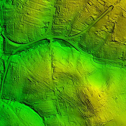
Our Digital Terrain Model (DTM) classification isolates the 'bare earth' by analyzing laser pulse reflections from man-made structures, vegetation, and the ground. By distinguishing between multiple returns—upper canopy vs. ground beneath—we derive precise elevation data to create accurate point cloud datasets of the terrain itself.
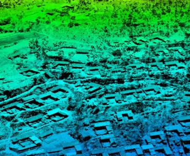
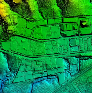
3D Modeling & Visualization
Beyond classification, we offer a full suite of 3D modeling products for GIS applications, architectural design, and simulators. We bridge the gap between raw data and immersive 3D graphic design.
3D Simulators GIS Apps Architectural Mod Visualization